White HouseSenateThe HouseSupreme CourtFederal ReserveDOJState DepartmentTreasuryCensusBudget OfficeTrade Representative
WashingTone
Informed by Washington, Defined by Insight
Wednesday, Feb 11, 2026
WashingTone
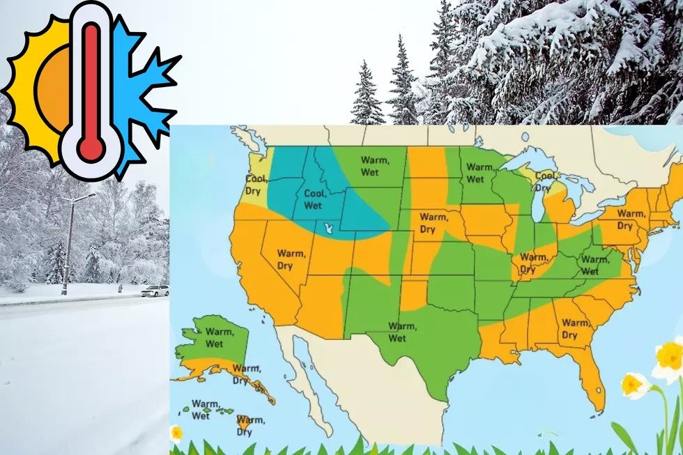
Washington’s Winter Sees Heavy Rain and Minimal Snow Amid Warm, Moist Storm Patterns
Unusually mild temperatures and abundant rain are suppressing snowfall and diminishing snowpack across the state
Washington State is experiencing an atypical winter characterised by frequent rain and far less snow than normal, driven by a combination of unusually warm conditions and moisture-rich atmospheric patterns.
Across the Pacific Northwest, seasonal precipitation has often fallen as rain rather than snow, even during typical winter months, because temperatures at low and mid elevations have remained above freezing during storm events.
This means that systems which might once have produced snow are now delivering rain in regional population centres and valleys, limiting snow accumulation on the ground.
Much of the rain this season has been associated with atmospheric rivers — long streams of moist air originating over the Pacific Ocean — which have swept inland and dropped large amounts of liquid precipitation.
These systems tend to elevate snow levels well above valley floors, so snow is confined to higher mountainous terrain rather than appearing in lowland areas.
The phenomenon has contributed to a significant reduction in snowpack across Washington’s mountains.
State measurements indicate that snowpack is well below normal for early February, with only around half of the typical snow water content observed at this point in the season.
Warm rain and lack of sustained cold spells have limited snow accumulation during months that normally build winter snow reserves.
Experts describe the current conditions as part of a wider snow drought affecting the broader western United States, where warmer winters have seen precipitation fall as rain more often than snow.
Local climatologists note that snowpack serves as a natural reservoir for spring and summer water supplies, and its depletion could have implications for water management, ecosystems and wildfire risk later in the year.
Despite the current pattern, meteorologists say it is still technically winter and forecast models show the potential for incoming systems with colder air that could produce snow at higher elevations.
However, the overall trend of warmer temperatures and rain-dominant storms has so far defined this winter’s weather in Washington.
Public responses have been mixed, with reduced snow benefiting drivers and outdoor workers while challenging ski areas and winter recreation businesses that depend on consistent snow cover.
As the season progresses, residents and officials continue to watch forecasts closely for shifts in temperature and precipitation type, mindful of the evolving impacts of the current weather pattern.